Kakeromajima: Japan’s Maritime Shield, 1867-1938

As introduced in the Part 1, Kakeroma is a paradise of lush forests, wildlife, and idyllic beaches. However, its unique geography also gave the island significant strategic value to the growing Japanese military of the Imperial era. Today, the Oshima Strait area, including Kakeroma, are fascinating destinations where history remains untouched.
Why Kakeroma?
Following the Meiji Restoration of 1867, Japan embarked on a complete transformation of its politics, economy, and armed forces. The latter resulted in the creation of the Imperial Japanese Army and Navy.
In the early years of the Meiji Era (1867-1912), Kakeroma was among Japan’s southernmost islands, only changing when the Ryukyu Kingdom (present-day Okinawa Prefecture) was formally annexed in 1879. This made the Oshima Strait, facing southwest towards Okinawa, and later, Taiwan, highly valuable. This was especially true regarding Okinawa - traditionally a Chinese ally and trading partner - whose diplomatic status was still uncertain for decades following the annexation. In contrast, the Amami Islands had been directly controlled by samurai from the Satsuma Domain since the 16th century, placing it far more securely under Japanese influence as an established core territory. This security, coupled with its geographical position, made it a valuable staging ground for any miliary action in the East China Sea.
By the beginning of the Taishō Era (1912-1926), Kakeroma and Amami Oshima were far from the new periphery of Japanese influence in Taiwan; Korea; and Manchuria, but it was still of interest to the military for its protective geography and strategic location between Okinawa and the mainland. As ships in the 19th and early 20th century were largely coal-fired, with less range to travel than today’s oil vessels, this position made Amami a valuable stopover point for military and civilian vessels alike.
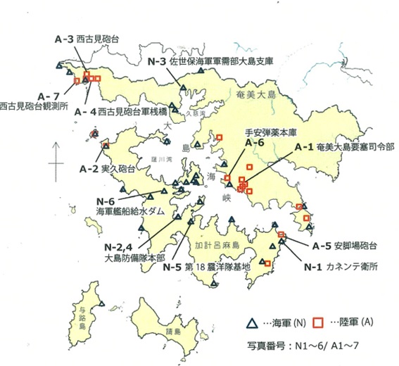
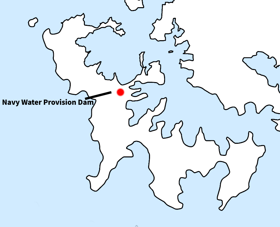
Map of key military ruins in Setouchi Town, which includes parts of southern Amami, as well as Kakeromajima and two other islands: black triangles/red squares represent Navy and Army facilities respectively (Setouchi Town Board of Education)
The map above shows how the geography of the two islands - Amami Oshima and Kakeromajima - created a position with strategic value to the Japanese military. Kakeroma stretches like a shield across Amami's southwestern coast, providing ideal protection for its port facilities. Any threats to Amami’s southern coast by sea would be forced to navigate the narrow strait, and be easily spotted. Capturing Kakeroma itself would be just as challenging due to its mountainous terrain and limited infrastructure. This geographical strength was recognized early on by the newly formed Imperial Japanese Army (IJA) and Navy (IJN), as the latter built the first of many bases on the islands in the form of coaling station on the Amami side of the strait in 1890.
Why do they Remain Today?
It may not be immediately clear why Kakeroma and Amami specifically have so many surviving bases. After all, Japan extensively fortified and developed all of its territories, especially during World War II – yet today, these two islands remain with perhaps the densest concentration of former Japanese military sites. Why?

Navy Water Provision Dam, built in 1938
The most immediate reason is that the Amami Islands were ultimately never invaded by the Allies before Japan's surrender in 1945. Even the plans drawn up for Operation Downfall - a proposed invasion of Japan itself - involved bypassing them in favour of islands closer to the mainland.
The islands did, however, suffer from devastating air raids, which destroyed their infrastructure and major population centers. Yet because so many of the defenses were built along the Oshima Strait - on remote, rugged Kakeroma and Amami’s lesser-developed southwest - they were not subject to the same degree of damage from the air. For the same reason, they exist today in rural, sparsely-populated areas often positioned in rough or difficult to access terrain. Surviving Japanese defenses on the mainland or Okinawa were quickly paved over and developed as the economy boomed postwar, but the remoteness of the islands and the bases' distance from major settlements has saved them from this fate, and they remain preserved to this day.
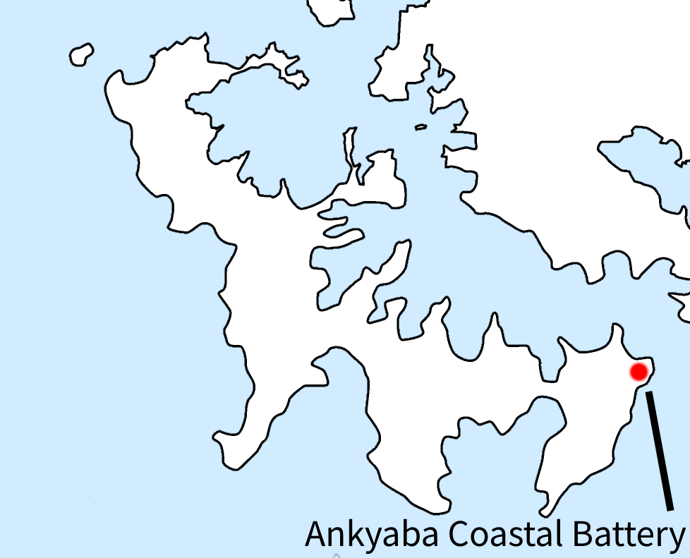
Ankyaba Coastal Battery
The value of Amami as a port is reflected in where its first defensive works were built.
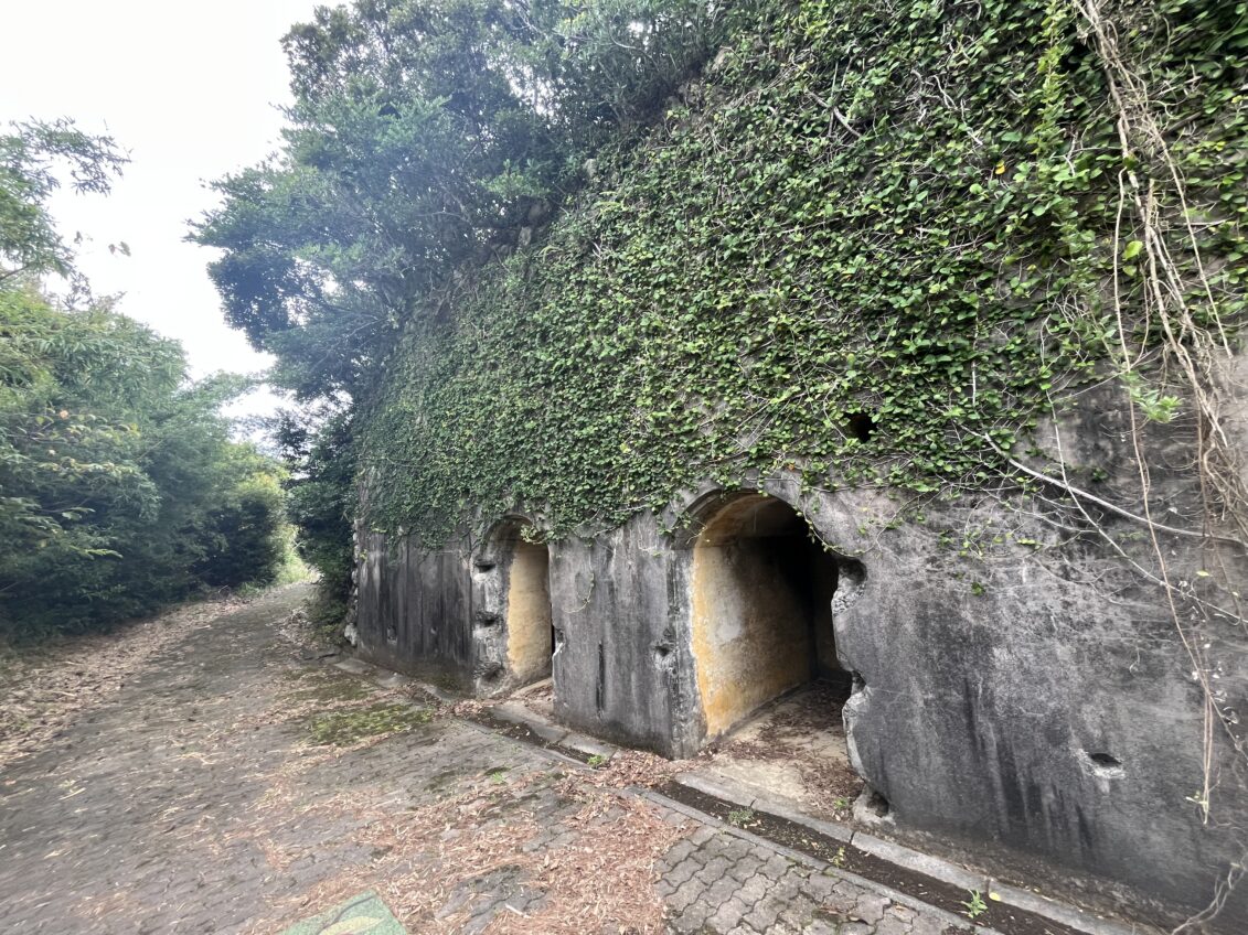
One of the few Army facilities on Kakeroma, the Ankyaba Coastal Battery guarded the eastern mouth of the Oshima Strait. It is also among the oldest, having been constructed in 1920.
Today, its concrete construction remains - and so are the twin entrances pictured about, which lead to what were once likely ammunition storages.
Today, the battery and its surrounding facilities are preserved as a public park, with benches and other additions. Combined with direct road access, this beautiful spot is easily accessible by car. However, there is a good deal of climbing that still must be done to reach the top.
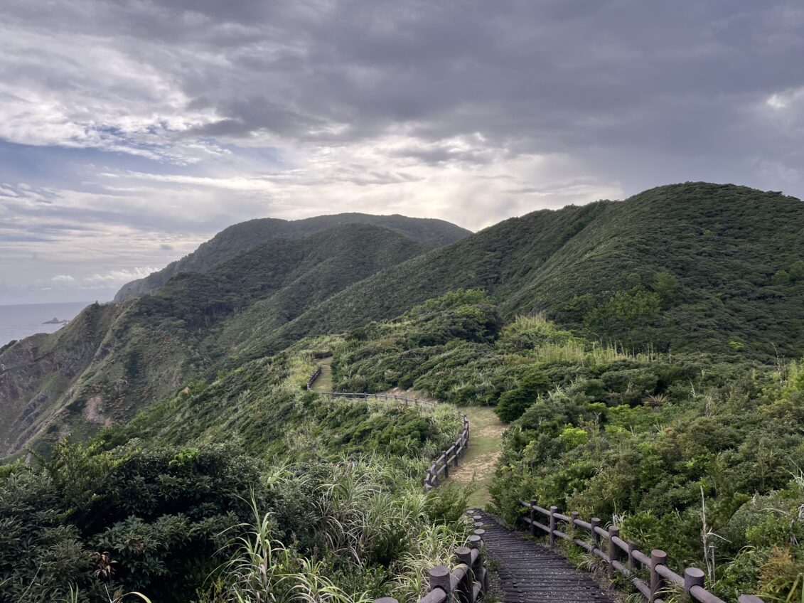
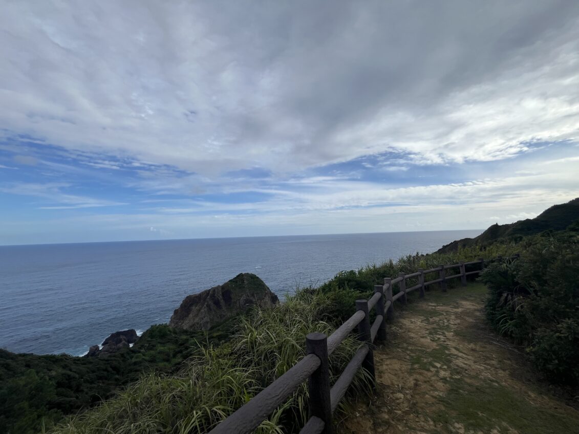
The terrain surrounding the battery is some of the most treacherous on Kakeroma, which suited it well as a military strongpoint. Today, its steep cliffs and rough tides below make for an otherworldly vista, perfectly captured from the observation points near the battery.
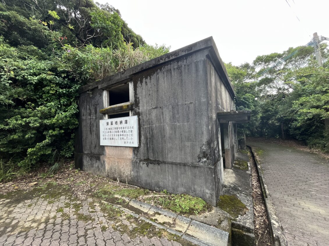
Close by is a depot originally built by the Army as a storehouse for small arms ammunition. It was constructed in 1921, just a year after the Coastal Battery. However, during the Pacific War, its role changed into being primarily a weapons locker for the Navy.
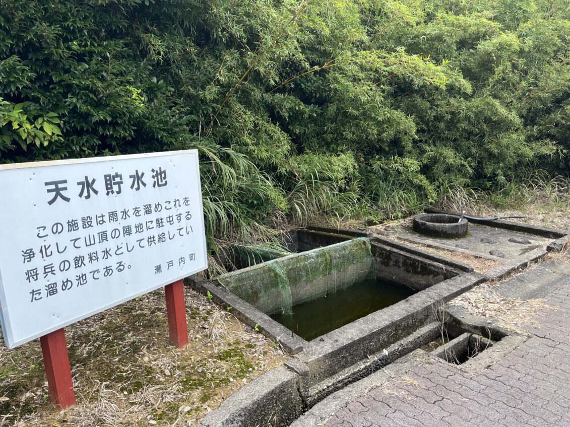
Also nearby is a rainwater collection basin, used for supplying drinking water for garrisoned soldiers and officers.
IJN Water Provision Dam

Located in a forest beyond the hamlet of Miura, this dam was built by the IJN in 1938, meant to store water for resupplying ships docked in the area. It is said that water flowed five kilometres from here to a point where it could refill ships’ fresh water stores.
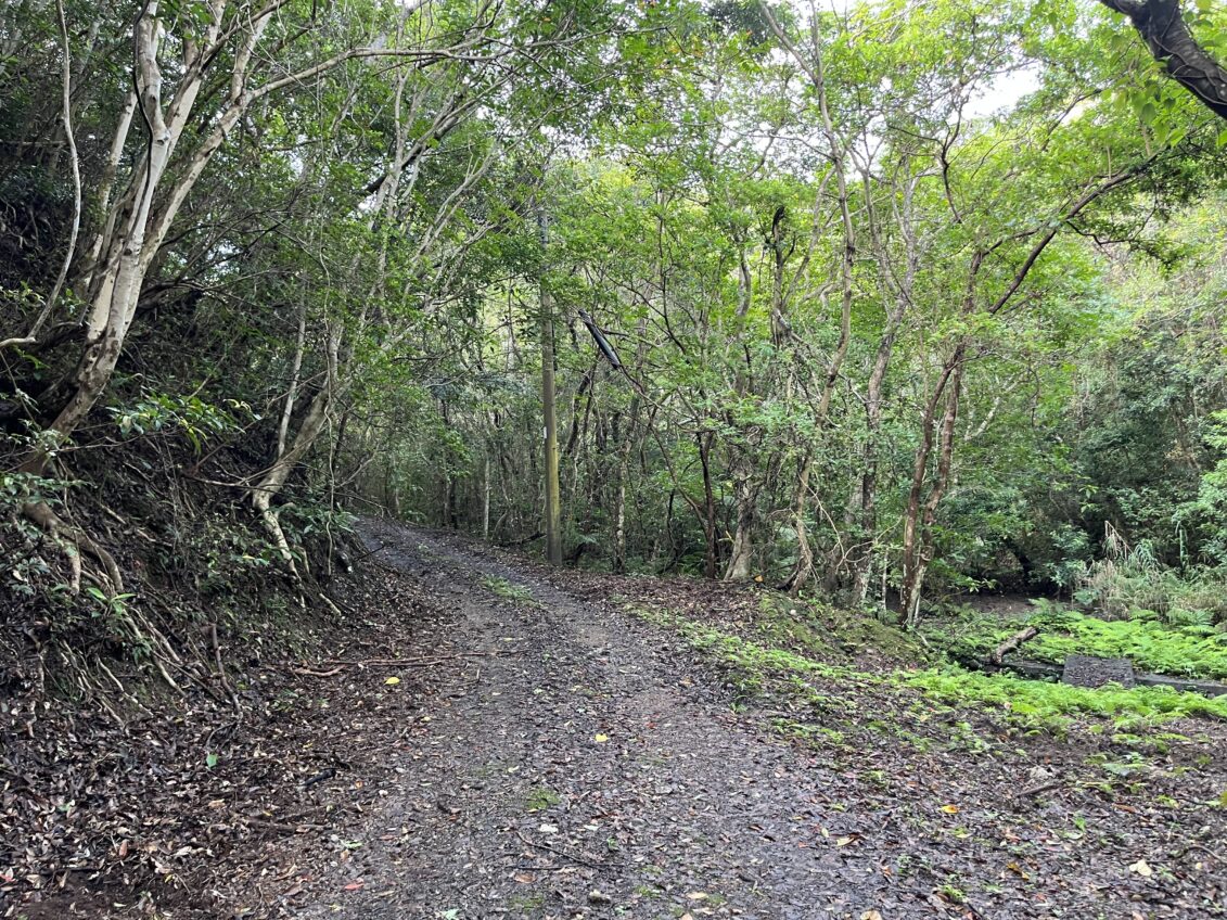
Today, it can be easily accessed by a walking trail, which directly branches from the main road. It is a walk up a moderate slope surrounded by the island's rich nature and wildlife.
At the top, you can walk directly across the dam and enjoy the beautiful elevated view of the surrounding forest, as well as observing the dam’s concrete construction; almost untouched since its construction over 85 years ago.
Here, we have looked at some of Kakeroma’s most significant early fortifications and facilities. However, as tensions rose both within Asia and across the globe, the island would receive even more investment for its role in the defense of Japan’s home waters.
Next time, we will take a closer look specifically at the island’s remaining wartime relics, and explore how the Pacific War shaped the future of Kakeroma and the Amami Islands.
WRITER
- 【Ankyaba Coastal Battery 】
- Google Maps
- 【Navy Water Provision Dam 】
- Google Maps